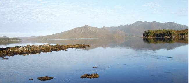
Port Davey Track, Tasmania | Leon Bedford
It feels like a world away, the secluded ocean inlet of Port Davey is located in the heart of Tasmania's wilderness World Heritage Area. It's here where you can lose yourself and disconnect from the busy urban life. It's here where the Lost Wold Plateau is located, jagged towering mountains, ancient rainforests with the rare Huon Pine, sweeping rivers and open plains.
Marion du Fresne the French navigator was said to be the first European to record the inlet. On the 13th of December 1798, Port Davey was passed by British explorer Matthew Flinders who had seen Marion's chart of the area. It wasn’t until 17 years later James Kelly sailed into the inlet and named it Port Davey after the Tasmanian Lieutenant Governor Thomas Davey. Port Davey could have been named Port Flinders or Port Fresne! There are some ruins and gravestones from the 1800's settlements when the whale and Huon Pine trades were in operation.
The Port Davey region comprises of Bathurst Harbour with its mirrored waters, a calming location to visit and at the coast side a dramatic fast-paced scenery that feels like the end of the earth. The rugged coastline with blowholes, caves and dramatic rock formations is a spectacular sight. Huon pines grow on the riverbanks of one of the most pristine river systems, the Davey River. The isolated and non-populated Port Davey is only accessed by foot, boat or light aircraft, it's a destination for those wanting to get away from it all and encompass the natural quiet surrounds.
A unique protected waterway, the Port Davey Marine Reserve features a layer of rich red-brown tannin freshwater which overlays the tidal saltwater from the Southern Ocean.
It is around the coastline where you may spot penguins, raptors, sea eagles, seals and further inland ducks, quolls, wombats, wallabies, platypus and the Tasmanian Devil. Look out for the rare orange-bellied parrot, the southwest wilderness is its breeding ground.
Head up to Balmoral Hill for a great position to view the nearly three times size of Sydney Harbour, Bathurst Harbour. Mount Rugby offers expansive 360-degree views of the southwest wilderness area.
The Port Davey Track is 70 kilometres in length and is a challenging 7-day trek. It starts at Scotts Peak Dam ends in Melaleuca with a scenic flight back to civilisation. The highlights include walking on quartzite tracks, ridge climbing, exploring through pockets of cool temperate rainforest remnants, button grass plains, crossing many pristine river systems, viewing the Arthur Range, feeling like you are in the middle of nowhere and rowing across the still Bathurst Narrows.
Another great way to explore this area is the Port Davey Kayak adventure. Over 7 days you'll paddle by kayak around the Port Davey Marine Reserve and Bathurst Harbour. Discover remote islands, pristine beaches and have the option to summit Mount Stokes. Enjoy the still and dramatic scenery, the tannin-stained waters, spot the sea life above and below the water and camp in beautiful wilderness.
Melaleuca is the main entry point for the Port Davey Track and South Coast Track. It is only accessible by sea, foot or air with a gravel airstrip and like Port Davey is an isolated unpopulated area.
Why not combine the Port Davey Track with the South Coast Track? This is the ultimate traverse across the entire southwest of Tasmania, one of the world’s greatest wilderness experiences.